


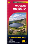

Superwalker XT30 Wicklow Mountains
€18.00
Detailed map for hillwalkers of the Wicklow National Park at 1:30,000 scale. Includes the spectacular Glendalough area and sections of St Kevin's Way, and the Wicklow Way which cross these mountains.
Features:
- As used by Dublin Wicklow Mountain Rescue Team
- Tough, light, durable and 100% waterproof
- Genuine, original, HARVEY mapping
- Easy to re-fold
- Exceptionally clear and easy to read
- Click here to view map coverage
- Scale: 1:30,000
- Ratio: 3.33cm = 1km
- Flat size: 696 x 486mm
- Folded size: 116 x 243mm
- Weight: 60gms
- Area of mapping: 488sqkm
- Double sided